What We Do
We currently provide services to a wide spectrum of clients ranging from startups, public to private companies. At Davacc, we carry out the following services:
Geo-Marketing Consulting
Geo-marketing is the integration of location-based intelligence into various aspects of marketing, including sales, planning and distribution. Parameters used in marketing research methodology, including from sampling, data collection, analysis, and presentation. Services include routing, territorial planning, and site selections. Davacc's expertise centres on the analysis and documentation of users' requirements and GIS ideals; whether on a project, departmental or enterprise-wide scale. The design and planning stages of GIS development are crucial to success, both from a technical viewpoint and in terms of the cost efficiency of the entire scheme.
Geographic Information Systems & Geo-database Development
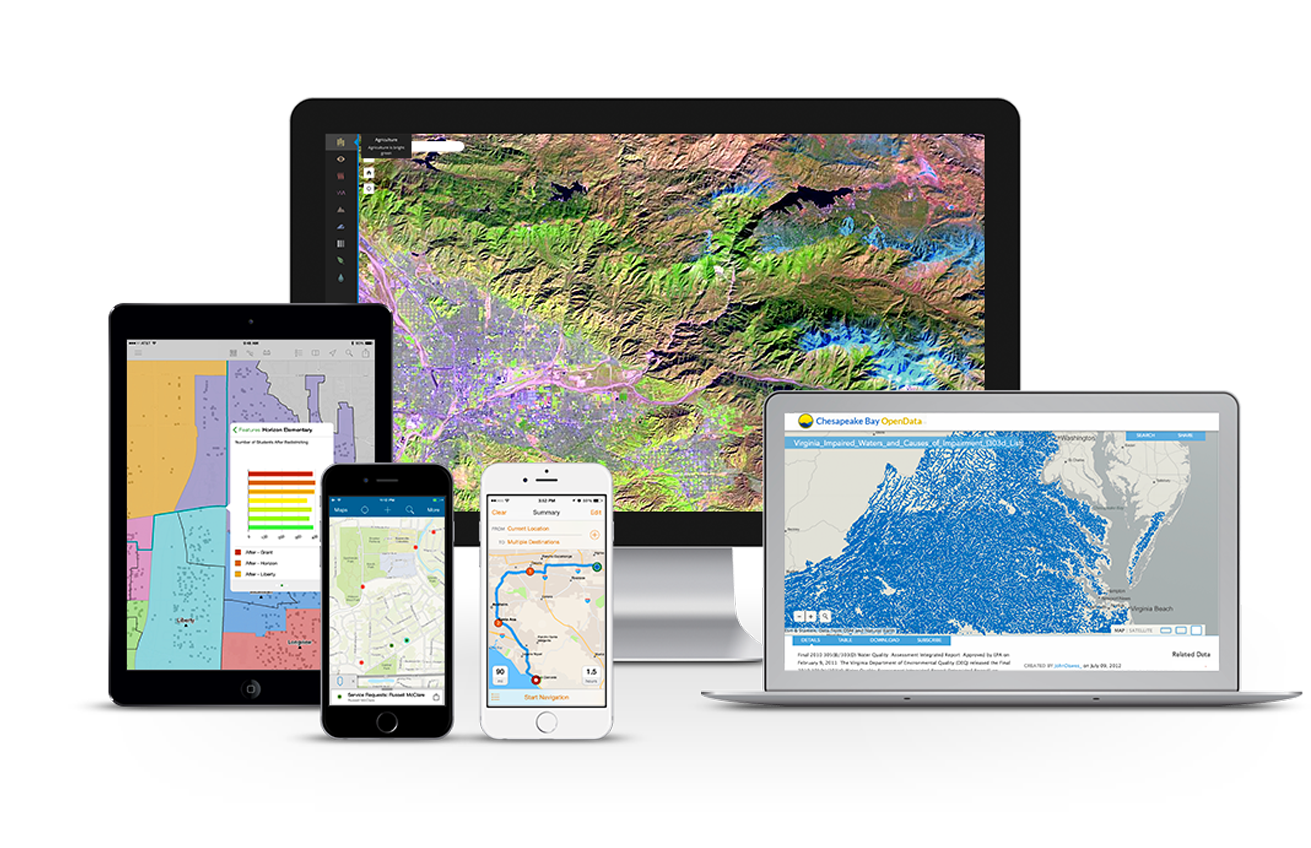
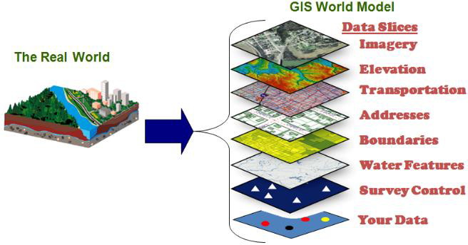
Geographic Information System (GIS) is a powerful decision-making tool using computer technology to integrate, manipulate and display a wide range of information to create a picture of an area's geography, environment and socio-economic characteristics.Starts by using a topographic map as base map, then add GIS overlays and integrate graphic and textual information from multiple databases/sources. The result is a customized and reliable tool that can support decision-making and problem solving, and provide almost instantaneous answers to complex/simple situations. We offer tailor made GIS and mapping solutions in water resource management, urban and rural mapping, utility mapping , database development, mapping of infrastructure, among others.
Application Development and Information Technology
Davacc helps develop your GIS applications using quality assured application development methodologies, whether for large, medium, or small scale Implementations. Based on the clients' specified requirements, Davacc will design and construct the application system, conduct system testing, and install and monitor system performance to meet agreed specifications. Davacc offers complete solutions to a variety of development partners including telecommunications, agricultural companies, government departments, service companies and manufactures. The solutions range from application package development to systems integration and audit. Davacc has the expertise to offer application packages tailored for every organization.

System Integrations
We offer integration services between existing traditional IT platforms such ERP, CRM’s, SharePoint with the traditional GIS platforms thereby offering integration solutions that not only maps your business data but reveals more, offers you additional insights.
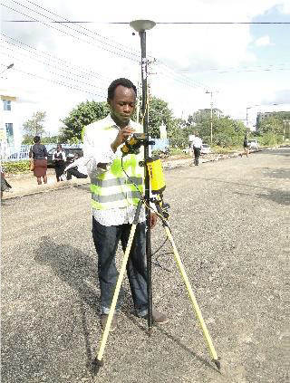
Land Surveying and Mapping
This includes cadastral, topographical and engineering surveying. This is an aspect of spatial measurements, representation, analysis, retrieval and display of spatial data concerning both the Earth's physical features and the built environment. Land surveying include sub-sections such as cadastral surveying, engineering surveying and topographical surveying. The different types of surveying carried out by Davacc arise from its competencies in service provision and technological skills of the company personnel.

Training Services
At Davacc, we provide various instructor -led GIS training programs including introduction to GIS, GIS Programming, mobile And Web GIS. These training services targets various groups across the board from novices to professionals.

Support & Software maintenance
Solutions and products from Davacc come with both system maintenance and trouble shooting. Moreover system set up and configurations are also bundled together as our products as one package.
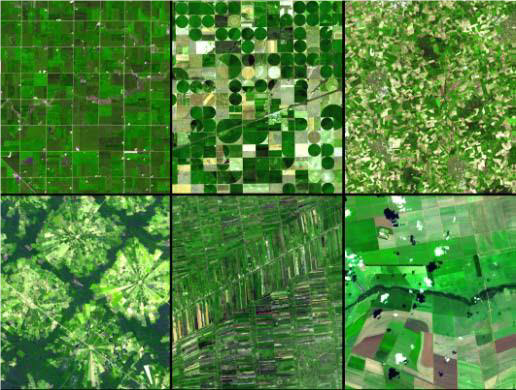
Aerial Photography and Remote Sensing
This refers to the acquisition of data from airborne and space borne platforms. Aerial photography uses aerial photographs taken from a flying aircraft to produce planimetric and topographical maps of the earth's surface (area of interest) and of features of the built environment. Effective use of ground control then enables the aerial photographs to be carefully compared and registered to the locations and characteristics of features identified in ground level surveys. Davacc has the competency to undertake aerial photography for both small and large projects.
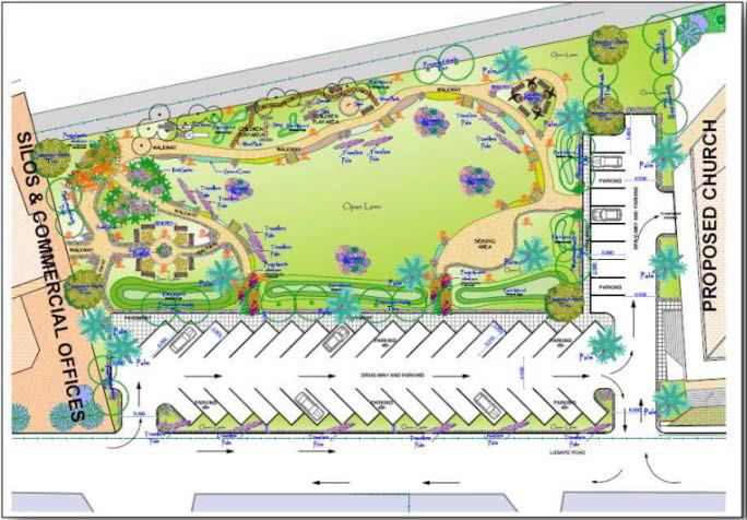
Physical and environmental Planning
Solutions and products from Davacc come with both system maintenance and trouble shooting. Moreover system set up and configurations are also bundled together as our products as one package.
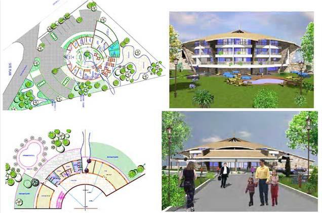
Engineering Consulting/3D Maps
Solutions and products from Davacc come with both system maintenance and trouble shooting. Moreover system set up and configurations are also bundled together as our products as one package.